3D mapping of urban environments
Posted By sculpteo on Feb 7, 2011 | 1 comment
SAR interferometry has been successfully used to make a topographic map of the surface of the Earth. However, there is uncertainty as to whether the radar returns come from the actual ground surface, or from a higher point such as the canopy of a forest.By investigating the interferometric properties of the polarimetric data, some information can be gained on where the scattering is coming from. In the ideal case, information can be obtained on both the height of the surface and on the height of the trees.
Currently, data come largely from Canada’s Radarsat-2 and Japan’s ALOS mission.
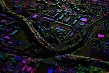
Polarimetric interferometic data may also be used to map urban environments in 3D, as the animation below shows.
This 3D reconstruction of Toulouse, France, was derived from SAR data collected by the airborne system RAMSES from ONERA, the French Aerospace Lab.
Sources : ESA and Canada Centre for Remote Sensing


 Connect with Google
 Connect with Facebook
