What’s Geo-modeling?
Posted By sculpteo on Dec 29, 2010 | 0 comments
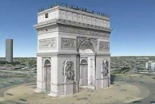
The process of making 3D models of real-life buildings that will appear in Google Earth is called geo-modeling.Google offers two of geo-modeling options:
– Geo-modeling with Building Maker
Google Building Maker is an online application specifically for geo-modeling. If the buildings you want to model are located in an area where Building Maker imagery is available, you should choose this method. French cities currently available are Marseille and Lyon. (See all available locations)
– SketchUp
Google SketchUp is a tool you can use to build 3D models of anything you like –including buildings for Google Earth. You should use SketchUp for geo-modeling if Building Maker is not available for the area you’re interested in, or if the buildings you want to model are very complex or unusual.
Discover SketchUp in this set of tutorials
Building Maker Manual
Source: SketchUp


 Connect with Google
 Connect with Facebook
